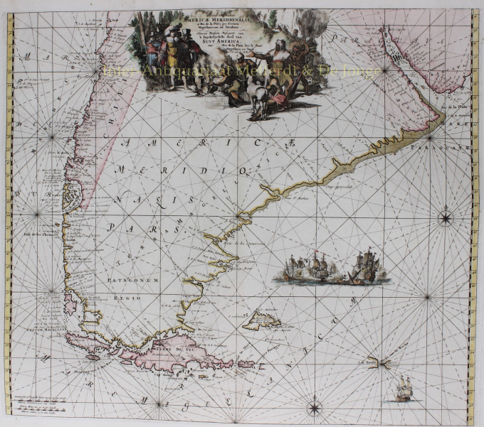
South America, Tierra del Fuego 1745
Reinier & Joshua Ottens
€ 1.250
Inter-Antiquariaat Mefferdt & De Jonge
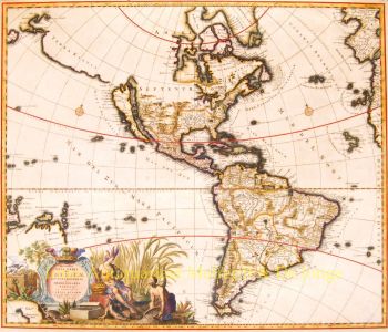
- About the artwork“Tractus Australior Americae Meridionalis a Rio de la Plata per Fretum Magellanicum ad Toraltum / Nieuwe Perfecte Pascaert van 't Suyderlyckfte deel van Suyt America, van Rio de la Plata door de straet Magellaen tot Toral.” Copper engraving published in Amsterdam by Reinier and Josua Ottens in around 1745. Coloured by a later hand. Size: approx. 48,5 x 56 cm. Beautiful sea chart of South America, extending from Rio de la Plata to the Magellan Strait and Tierra del Fuego archipelago. The dramatic cartouche depicts an encounter between Tierra del Fuego natives and Dutch explorers, where natives show the wealth of their land: (melted) gold and cattle. The Dutch merchant Jacob le Maire and his captain Willem Schouten rounded Cape Horn in 1616 on their way to discover a route towards the East Indies. A naval battle unfolds in the South Atlantic, presumably a scene from the Second Anglo-Dutch War. The chart, first published by Frederick de Wit, is one of the most elegant and detailed charts of South America published in the 17th Century and was likely engraved by Romeyn de Hooghe. Our map is a re-issue from the early 18th century by the Ottens family. Price: Euro 1.250,-
- About the artist
The period from 1630 to 1700 was the "golden age" of Dutch cartography. The maps were perceived as works of art, manual work was highly valued, engraving was at the highest level, but from the point of view of the geographical accuracy, maps of Dutch masters were inferior to maps produced in Germany, France and other European countries.
Joachim, the founder of the Ottens firm, was born in Amsterdam and initially worked as a copper engraver. In 1711 he founded his own firm engaged in publishing and printing business, selling books, maps, postcards and illustrating them.
Although Joachim died a few years later, his sons, Renier and Joshua, successfully continued their father's business. The most significant contribution to the cartography of the Ottens family was the huge multivolume atlases they made to order, such as Atlas Major. Some Atlas issues are composed of more than 800 separately issued maps.
Are you interested in buying this artwork?
Artwork details
Related artworks
- 1 - 4 / 4
- 1 - 4 / 24
- 1 - 4 / 12

