Utrecht / Lancio 1635
Willem Janszoon Blaeu
€ 650
Inter-Antiquariaat Mefferdt & De Jonge
- A proposito di opere d'arte
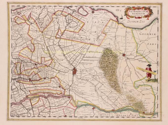
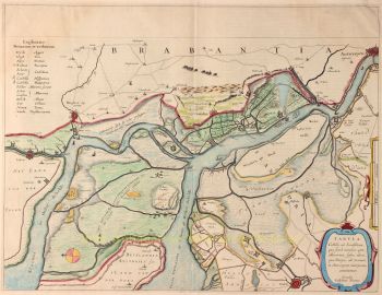
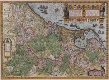
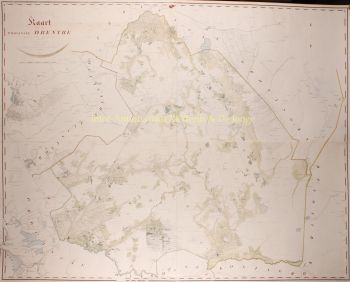
THE HOLIDAY OF UTRECHT "Ultrajectum Dominium". Copper engraving published in 1635 by Willem Blaeu. Verso: French text. Coloured by hand. Sizes 38 x 49,5 cm. Willem Blaeu made this map based on one by Balthasar Florisz. van Berckenrode from 1620. There were no country houses on the Vecht or in 's-Graveland at that time. Monasteries on the Vecht are still depicted, but by then they had already fallen into ruin. This was the time when canals were dug between towns and existing waterways were made suitable for towing ships. In 1599, a towpath was constructed along the Amstel River from Amsterdam to Uithoorn, and between 1626 and 1628 parts of the Amsterdam-Utrecht section were constructed. The first towpaths were constructed as connections between two cities, but in the course of the 17th century more and more separate towpaths were linked. This is how large canal networks came into being. From 1588 (until the French era), the Utrecht District was one of the provinces of the Republic of the Seven United Provinces. What the map does not tell you is that when it appeared, a plague epidemic was raging in Utrecht, which would not stop until 1638. As much as 15 percent of Utrecht's population would die as a result of this disease. Blaeu was inspired to make an atlas like no other in the world. Financial reasons were secondary; the risk was too great for that. But there was rivalry between the publishers of Blaeu and Janssonius and motives such as prestige and display were at least as important. He wanted to create something that would overwhelm the civilised world in the heyday of Amsterdam's power. Out of this ambition appeared the "Atlas Maior". Price: Euro 650,-
- A proposito di opere artista
"Willem Janszoon Blaeu e suo figlio Joan incarnavano l'"età d'oro" della cartografia olandese. Lavorando durante il diciassettesimo secolo, Willem Blaeu disegnò una serie di mappe rivoluzionarie e pubblicò il primo atlante.
Nacque nel 1571 ad Amsterdam e lavorò inizialmente come impiegato nel commercio di aringhe di famiglia. Tuttavia, non era contento della sua occupazione e lasciò la casa nel 1594 per studiare matematica sotto Tycho Brahe, il famoso astronomo. Blaeu era un bravo studente che impressionò molto il suo tutor, e quando i suoi studi furono completati tornò ad Amsterdam e iniziò un'attività come cartografo. La sua attività fiorì e la sua reputazione crebbe. Fu il primo cartografo a produrre mappe a foglio singolo di molti paesi europei.
Nel 1605 realizzò una mappa murale del mondo, comprendente 20 fogli, ciascuno largo 8 piedi. Questa mappa era di gran lunga la più accurata del periodo e ha dato un contributo eccezionale alla conoscenza della geografia mondiale.
La sua mappa rimase la più accurata fino al 1648, quando suo figlio, Joan, che divenne anche un famoso cartografo, la aggiornò. Ma il suo risultato più importante fu la produzione del primo atlante nel 1630. Il nome Blaeu era in realtà un soprannome di famiglia che Willem assunse dopo che si era verificata confusione tra lui e il suo grande rivale Joannes Jansonius.
Sei interessato ad acquistare questa opera d'arte?
Artwork details
Related artworks
- 1 - 4 / 8
- 1 - 4 / 24
- 1 - 4 / 12

