Pulseira boucheron boules 1794
Laurie and Whittle
€ 975
Inter-Antiquariaat Mefferdt & De Jonge
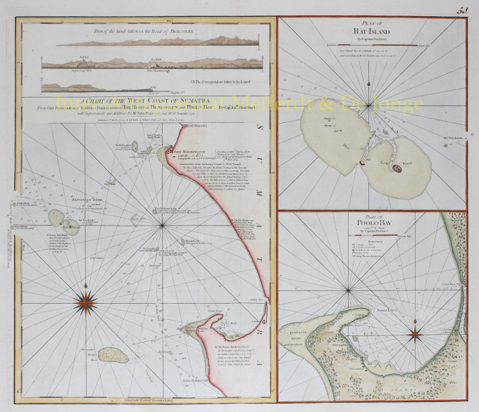
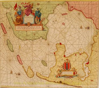
- Sobre arteINDONESIA NAUTICAL CHART "A Chart of the West Coast of Sumatra from Old Bencoolen to Buffaloe Point containing the Road of Bencoolen and Poolo Bay. Plan of Rat Island. Plan of Poolo Bay."Copper engraving from "The East-India Pilot, or Oriental Navigator" published in London by Robert Laurie and James Whittle in 1794. Coloured by a later hand. Size: approx. 63,5 x 53,3 cm. Nautical chart of the west coast of Sumatra in the vicinity of Bencoolen or Fort Marlborough. The map is divided into three sections, the left hand side being a general nautical chart of the approaches to Bencoolen and Fort Marlborough, the right hand plans are details of Rat Island and Poolo Bay. Bencoolen (Bengkulu) was established as a pepper-trading center by the British East India Company in 1685. By the time this map was drawn Bencoolen has been renamed "Old Bencoolen", being superseded in 1714 by Fort Marlborough just to the south. The map offers considerable detail on the approaches to Bencoolen for which Rat Island (top right submap) is an important marker, as well as a staging post were vessels could dry anchor and dry nets. Poolo Bay (Pulau Bay) (bottom right submap), some seven miles south of Fort Marlborough, was at the time an excellent harbor and anchorage. There the map identifies warehouses as well as lime ovens and a fresh water source. Though most charts in the East-India Pilot were derived from earlier maps prepared for Jean-Baptiste d'Apres de Mannevillette's 1745 Neptune Oriental, this particular chart is a new production unique to Laurie and Whittle. The map offers rich detail including countless depth soundings, notes on the sea floor, commentary on reefs, rhumb lines, shoals, place names and a wealth of other practical information for the mariner. Cartographically it was derived from surveys by Captain Joseph Huddart, John Price, and a Mr McDonald. Price: Euro975 (excl. VAT/BTW)
Você está interessado em comprar esta obra de arte?
Artwork details
Categoria
Related artworks
- 1 - 4 / 24
- 1 - 4 / 12

