Carte des Bermudes 1630
Willem Janszoon Blaeu
€ 2.250
Inter-Antiquariaat Mefferdt & De Jonge
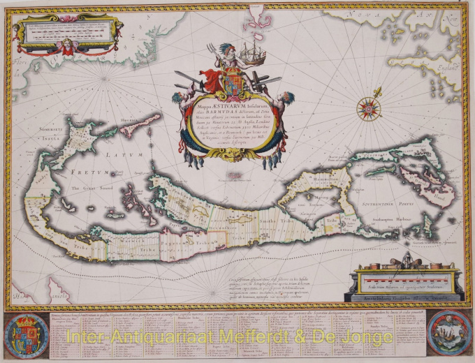
- Sur l'oeuvre d'artMappa Aestivarum Insularum, alias BarmudasPublished by Willem Blaeu in Amsterdam approx. 1630. Blaeu based his work on John Speed's very accurate map of 1626-1627. It shows the island divided into tribes and lots. Below the map itself appear the names of the first proprietors and the number of shares assigned to each. A splendid cartouche shows Neptune astride the Royal Arms holding a ship. The miniature map below the cartouche shows the correct proportion of the island to the coast of the mainland. Further adorned with scale cartouches, coats of arms and compass rose with a fleur-de-lys. The map is superimposed over a map of the Atlantic with the coastlines of Britain, North America and Hispanola showing the location of Bermuda. Coloured by a later hand. Size: 40,4 x 53,1 cm. Price: Euro2.250,- (excl. VAT/BTW)
- Sur l'artiste
"Willem Janszoon Blaeu et son fils Joan ont incarné "l'âge d'or" de la cartographie néerlandaise. Travaillant au XVIIe siècle, Willem Blaeu a dessiné un certain nombre de cartes révolutionnaires et publié le premier atlas.
Il est né en 1571 à Amsterdam et a d'abord travaillé comme commis dans le commerce familial du hareng. Cependant, il n'était pas satisfait de son occupation et quitta la maison en 1594 pour étudier les mathématiques avec Tycho Brahe, le célèbre astronome. Blaeu était un bon élève qui impressionnait beaucoup son tuteur, et quand ses études furent terminées, il retourna à Amsterdam et s'installa comme cartographe. Son entreprise a prospéré et sa réputation a grandi. Il a été le premier cartographe à produire des cartes à feuille unique de nombreux pays européens.
En 1605, il a fait une carte murale du monde, englobant 20 feuilles, chacune de 8 pieds de diamètre. Cette carte était de loin la plus précise de l'époque et apporta une contribution remarquable à la connaissance de la géographie mondiale.
Sa carte est restée la plus précise jusqu'en 1648, lorsque son fils, Joan, qui est également devenu un célèbre cartographe, l'a mise à jour. Mais sa plus grande réalisation fut la production du premier atlas en 1630. Le nom Blaeu était en fait un surnom de famille que Willem prit après une confusion entre lui et son grand rival Joannes Jansonius.
Êtes-vous intéressé par l'achat de cette oeuvre?
Artwork details
Related artworks
- 1 - 4 / 8
Artiste Inconnu
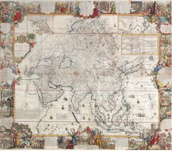
A large wall map of Asia by Nicolas de Fer 1647 - 1720
Prix sur demandeZebregs & Röell - Fine Art - Antiques
1 - 4 / 24- 1 - 4 / 12

