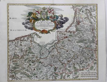
Seventeen Provinces 1635
Willem Janszoon Blaeu
EncrerPapierImprimer
40 ⨯ 50 cm
€ 1.450
Inter-Antiquariaat Mefferdt & De Jonge
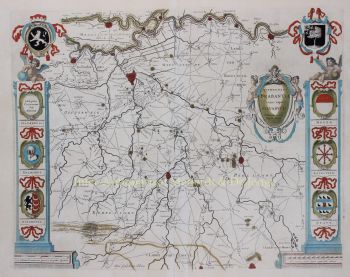
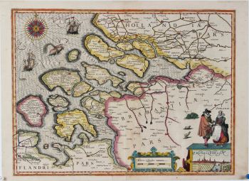
- Sur l'oeuvre d'artFAMOUS MAP OF THE SEVENTEEN PROVINCES “Novus XVII Inferioris Germaniæ Provinciarvm Typvs de integro multis in locis emendatus à Guliel. Blaeu.” Copper enrgaving made by Josua vanden Ende, here in its 3rd state published by Willem Bleau in 1635. Verso: French text. With original hand colouring. Size: 40 x 50,5 cm. The bottom right shows a cartouche with scale bar and the address of Willem Blaeu: "op 't Water in de Vergulde Zonnewyzer" [current day Damrak in Amsterdam]. On the left a cartouche a list of towns and villages per province and a legend of the symbols used. In the North Sea we see a 32-piece compass rose, a sea monster and many ships. The Fall of Antwerp in 1585 caused a de facto separation between the Northern and Southern Netherlands and the seventeen provinces split into two parts. A border arose whereby the Seventeen Provinces were split into the Republic of the Seven United Netherlands and the Southern Netherlands. Because of emigration and a change in the political situation, the economic center of The Netherlands shifted to the north. The Dutch Revolt against the Spaniards continued and meanwhile religion divided the entire continent into two parts. All of Europe was now at war, and conflicts were not resolved until the Peace of Münster in 1648. In the treaty Dutch Republic was recognized by Spain as sovereign state. At that time, the separation of the northern and southern Netherlands was a fact. Nevertheless, maps of the Seventeen Provinces regularly occur up to about 1800. This was partly beacause of the enormous costs for the fieldwork and engraving that came with the production of new maps, but was also due to the unclear borders of the area in the east and south of the Dutch Republic. Reference: H.A.M. van der Heijden “Oude kaarten der Nederlanden, 1548-1794", map 64.3 Price: Euro 1.450,-
- Sur l'artiste
"Willem Janszoon Blaeu et son fils Joan ont incarné "l'âge d'or" de la cartographie néerlandaise. Travaillant au XVIIe siècle, Willem Blaeu a dessiné un certain nombre de cartes révolutionnaires et publié le premier atlas.
Il est né en 1571 à Amsterdam et a d'abord travaillé comme commis dans le commerce familial du hareng. Cependant, il n'était pas satisfait de son occupation et quitta la maison en 1594 pour étudier les mathématiques avec Tycho Brahe, le célèbre astronome. Blaeu était un bon élève qui impressionnait beaucoup son tuteur, et quand ses études furent terminées, il retourna à Amsterdam et s'installa comme cartographe. Son entreprise a prospéré et sa réputation a grandi. Il a été le premier cartographe à produire des cartes à feuille unique de nombreux pays européens.
En 1605, il a fait une carte murale du monde, englobant 20 feuilles, chacune de 8 pieds de diamètre. Cette carte était de loin la plus précise de l'époque et apporta une contribution remarquable à la connaissance de la géographie mondiale.
Sa carte est restée la plus précise jusqu'en 1648, lorsque son fils, Joan, qui est également devenu un célèbre cartographe, l'a mise à jour. Mais sa plus grande réalisation fut la production du premier atlas en 1630. Le nom Blaeu était en fait un surnom de famille que Willem prit après une confusion entre lui et son grand rival Joannes Jansonius.
Êtes-vous intéressé par l'achat de cette oeuvre?
Artwork details
Related artworks
- 1 - 4 / 8
- 1 - 4 / 24
Artiste Inconnu
N.d. Murder of Johan and Cornelis de Witt in The Hague1672
€ 2.250Jongeling Numismatics & Ancient Art
 Sélectionné par
Danny Bree
Johannes Evert Akkeringa
'Nettenboetsters' in the Dunes1861 - 1942
Prix sur demandeStudio 2000 Art Gallery
1 - 4 / 24Artiste Inconnu
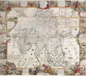
A large wall map of Asia by Nicolas de Fer 1647 - 1720
Prix sur demandeZebregs & Röell - Fine Art - Antiques
1 - 4 / 24- 1 - 4 / 12


