MUITO RARO PRIMEIRO MAPA IMPRESSO DE AMESTERDÃO, UMA CIDADE EM ASCENSÃO 1544
Cornelis Anthonisz Theunissen
Papel
100 ⨯ 103 cm
€ 175.000
Inter-Antiquariaat Mefferdt & De Jonge
- Sobre arte
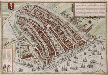
“De vermaerde koopstadt van Amstelredam” [The renowned trading city of Amsterdam], woodcut printed from twelve blocks, with text printed in letterpress, made in 1544 by Cornelis Anthonisz. Size (including decorative border): approx. 100.5 x 103.5 cm. In 1544, Amsterdam was part of the Habsburg Empire under Emperor Charles V. The city had only about 12,000 inhabitants, and construction was largely confined to the area within the Singel, a small part of the Amstel River, the Kloveniersburgwal, and the Geldersekade. There was no Grachtengordel ["canal belt"] as we know it today. The map shows developments in the Lastage, the area east of the Geldersekade. Here, just a stone's throw from the Oude Kerk, workers are active in shipyards and sawmills. This suggests that the city was beginning to build its trade over the water. The connection to shipping and trade, and implicitly its reliance on it, is further highlighted by the numerous ships depicted both within and beyond the wooden palisades in the IJ waterfront. Billowing sails, salutes from cannon shots, and small boats coming and going illustrate a city on the brink of becoming one of the world’s most important. To the west of the city (under clouds in the top right corner) are the market gardens that were later urbanized during the expansions of 1585-1586 and 1610-1615. Within the city walls, several buildings are visible, including the Schreierstoren, which still stands today. Also shown are several churches, the Munttoren (then part of the Regulierspoort), and the Waag on the Nieuwmarkt. Cornelis Anthonisz. is thought to have been inspired by a map of Venice, also in bird’s-eye view, created in 1500. Both maps are adorned with a mythological god; however, while the map of Venice features both Mercury and Neptune, Cornelis Anthonisz. includes only Neptune. Interestingly, this sea god on the Amsterdam map appears to be shouting, his mouth open, showing a less-than-perfect set of teeth. By choosing a high vantage point, Cornelis Anthonisz. skillfully combined detailed building depictions with an ability to show the layout of city walls, roads, river, and canals. An impressive feat, especially considering that Anthonisz. only had access to towers to view the city from a higher perspective. In his imagination, he flies above the city, peering over fences and observing city life. Midway along the Amstel, which divides the city, the Dam (with the old town hall) is clearly recognizable. Ships dock there to trade their goods. --- There are only six known editions of this map, printed between 1544 and 1664 from the same twelve woodblocks. The map’s image remained unchanged; only the typesetting in the text block was adjusted for each edition. Our example is the third edition, printed between 1545 and 1553. This woodcut is based on a map of Amsterdam that Cornelis Anthonisz. painted on wooden panels in 1538. This was actually the first map of the city ever made. Six years later, this first printed map of Amsterdam appeared. Notably, our example was supplemented (presumably in the 18th century) with a manuscript legend listing 54 places and buildings, both within and outside the city. Literature: Marc Hameleers (2013) “Kaarten van Amsterdam 1538-1865”, no. 2 A.E. d'Ailly (1934) “Catalogus van Amsterdamsche plattegronden”, no. 30 Hollstein “Dutch & Flemish Etchings, Engravings, and Woodcuts ca. 1450 – 1700”, no. 47-III Frederik Muller (1863-1882) "Nederlandsche historieplaten", no. 393-A: “an equally beautiful, accurate, important, and rare map” Price: Euro 175.000,- (incl. frame)
- Sobre artista
Cornelis Antonisz. (frequentemente escrito "Anthonisz".) Theunissen foi um ilustre pintor, gravador e cartógrafo holandês nascido em Amesterdão em 1499 e activo no início do século XVI. É conhecido pelas suas contribuições para a cartografia e representações de paisagens urbanas, principalmente pelos seus mapas panorâmicos de Amesterdão.
Antonisz. era oriundo de uma família artística - era sobrinho de Jacob Cornelisz. van Oostsanen, um artista proeminente da época, com quem provavelmente aprendeu as bases da pintura e da gravura. O seu mapa detalhado em xilogravura de Amesterdão de 1538, encomendado pelo governo da cidade, é considerado uma das suas obras mais significativas.
Este mapa, intitulado Bird’s Eye View of Amsterdam, é uma das primeiras representações conhecidas da cidade e reflete o crescente desenvolvimento urbano e a atividade movimentada de Amesterdão no início do período renascentista. O nível de detalhe do seu mapa mostra não só um sentido apurado de habilidade artística, mas também uma compreensão avançada da geografia e da organização espacial, que eram notáveis para a época.
Além dos seus mapas, Cornelis Anthonisz. esteve também envolvido em vários projetos de pintura, incluindo retratos e cenas religiosas, embora o seu trabalho cartográfico continue a ser o seu legado mais duradouro. A sua influência estendeu-se às gerações subsequentes de cartógrafos holandeses, uma vez que as suas obras serviram como referências importantes para os mapas posteriores de Amesterdão e de outras regiões da Holanda. Antonisz. faleceu por volta de 1553, mas os seus contributos para a cartografia holandesa e para o género paisagem urbana continuam a ser celebrados na história da arte e da cartografia na Holanda.
Você está interessado em comprar esta obra de arte?
Artwork details
Related artworks
- 1 - 4 / 24
Artista Desconhecido
UM MODELO JAPONÊS DE UM NORIMONO, UM PALANQUIM1650 - 1700
Preço em pedidoZebregs & Röell - Fine Art - Antiques
 Com curadoria de
Danny Bree
Shiba Kokan
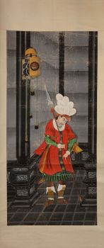
Pintura de um holandês fantásticoearly 19th
Preço em pedidoZebregs & Röell - Fine Art - Antiques
Artista Desconhecido
Holandeses em miniatura (Netsuke)1700 - 1900
Preço em pedidoZebregs & Röell - Fine Art - Antiques
1 - 4 / 24- 1 - 4 / 24
- 1 - 4 / 12


